British Columbia. Former name: Fraser River drainage
Former name of Robson River
53.0333 N 119.25 W Google — GeoHack
Earliest known reference to this name is 1863 (Milton and Cheadle)
Not currently an official name.
Former name of Robson River
53.0333 N 119.25 W Google — GeoHack
Earliest known reference to this name is 1863 (Milton and Cheadle)
Not currently an official name.
This former name appears on:
Milton and Cheadle’s map 1865
Trutch’s map of BC 1871
George Monro Grant’s map of Yellowhead Pass 1872
Coleman’s map of Mount Robson 1910
Collie’s map Yellowhead Pass 1912
Milton and Cheadle’s map 1865
Trutch’s map of BC 1871
George Monro Grant’s map of Yellowhead Pass 1872
Coleman’s map of Mount Robson 1910
Collie’s map Yellowhead Pass 1912
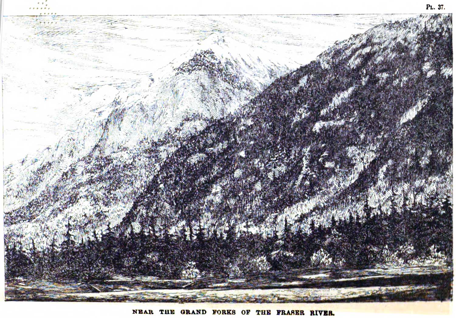
Near the Grand Forks of the Fraser River. George Monro Grant, plate 37
Ocean to Ocean: Sandford Fleming’s Expedition through Canada in 1872
July 14 1863 — A few hours’ travelling in the morning of the 14th brought us to the Grand Fork of the Fraser, where an important branch from the north or north-east flows by five separate mouths into the main body of the Fraser, which we had been following thus far. Here we pulled up, in order to search carefully for safe fords by which to cross these numerous swollen streams. This Grand Fork of the Fraser is the original Tête Jaune Cache, so called from being the spot chosen by an Iroquois trapper, known by the sobriquet of the Tête Jaune, or Yellow Head,” to hide the furs he obtained on the western side
References:
- Milton, William Wentworth Fitzwilliam [1839–1877], and Cheadle, Walter Butler [1835–1910]. The North-West Passage by Land. Being the narrative of an expedition from the Atlantic to the Pacific, undertaken with the view of exploring a route across the continent to British Columbia through British territory, by one of the northern passes in the Rocky Mountains. London: Cassell, Petter and Galpin, 1865, p. 257. Internet Archive
Also see:
![R.E. Gosnell, Legislative Librarian [1894 to 1897]](/wp-content/uploads/2022/09/r-e-gosnell.jpg)