Flows 1290 kilometres from Columbia Icefield to Lake Athabasca
58.6667 N 110.8333 W — Map 74L10 — Google — GeoHack
Earliest known reference to this name is 1800 (David Thompson)
Name officially adopted in 1948
Topo map from Canadian Geographical Names
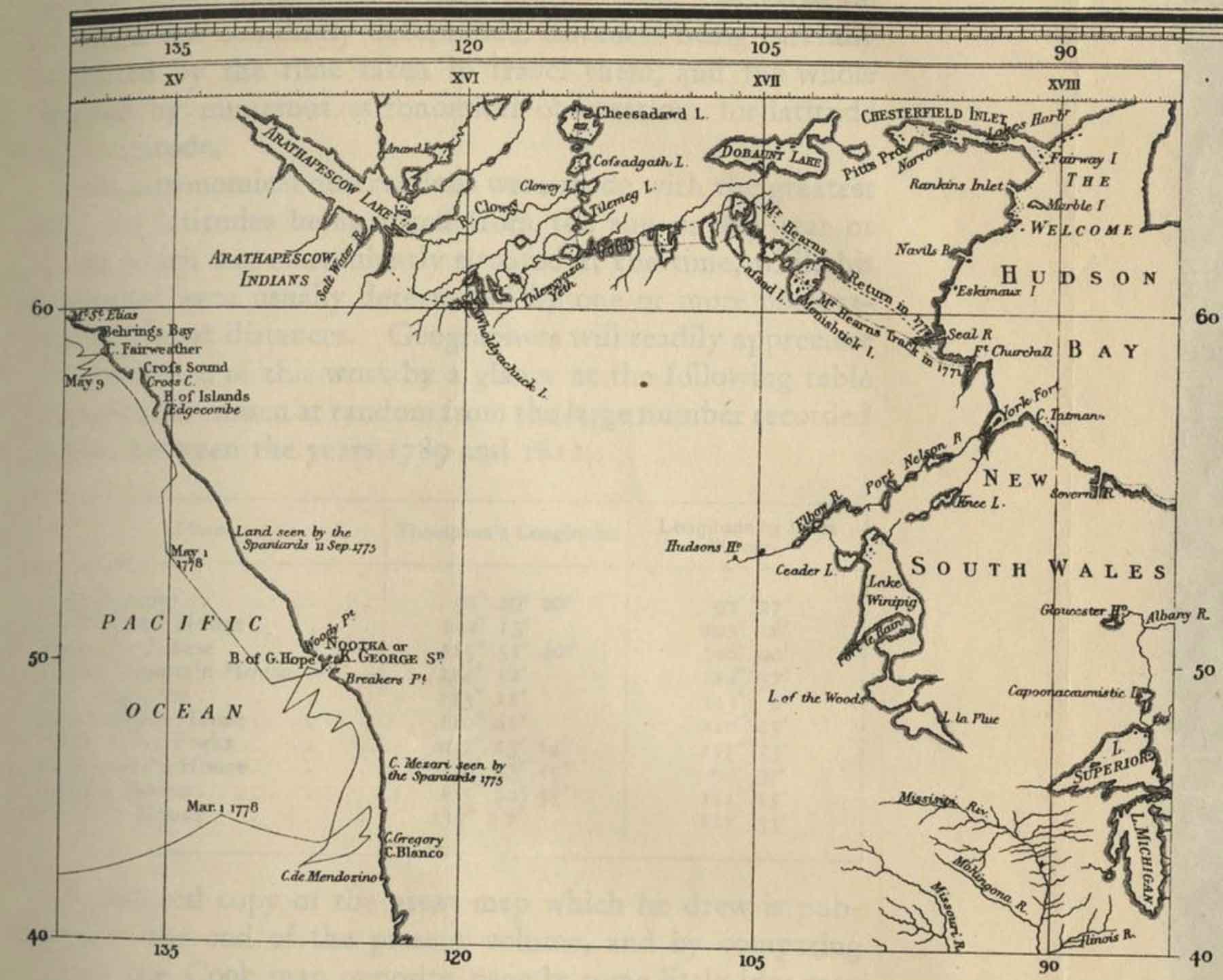
Mackenzie’s map North America 1803
David Thompson’s map North-West Territory of the Province of Canada 1814
John Arrowsmith’s map BC 1859
Milton and Cheadle’s map 1865
Trutch’s map of BC 1871
Tolmie and Dawson map Indian Tribes of BC 1884
McEvoy’s map Yellowhead Pass 1900
Schäffer map of visits in 1907 and 1908
“Athabasca” is from the Cree language and is said to mean “an area of grass or reeds.” The name likely refers to the muddy delta of the river where it flows into Lake Athabasca.
In 1790, the name of the river was recorded as “Great Arabuska.” In 1801 it was labelled “Athapasco.” The Arrowsmith map of 1802 shows a slight variation as “Arthapescow.” In the late eighteenth century, the Dunne-za people who lived along its banks called it the “Elk River,” and it appears as “Elk River” on the 1801 map by Alexander Mackenzie [1764–1820] .
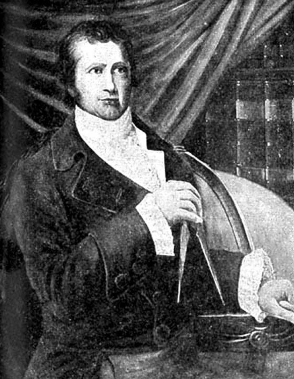
David Thompson [1770–1857] and Peter Fidler [1769–1822], who explored the middle section of the river in 1799–1800, both referred to it in their journals as the “Athabasca.”
In 1820, George Simpson [1792–1860], the governor of the Hudson’s Bay Company, referred to it as the “Athabasca or Elk River.” Today, local residents also refer to the feature as “Big River,” the Cree version of which was in use in 1880 when George Mercer Dawson labelled it as “Athabasca River or Mus-ta-hi-sî-pî.”
“Athabasca River / Rivière Athabasca” is among the 75 “Pan-Canadian names,” large and well-known Canadian features and areas designated in Treasury Board Circular 1983-58 to require presentation in both official languages of Canada on federal maps.
Mackenzie’s map North America 1803
- Thompson, David [1770–1857]. David Thompson’s Narrative of his explorations in western America, 1784-1812. Joseph Burr Tyrrell, editor. Toronto: Champlain Society, 1916. University of British Columbia
- Simpson, George [1792–1860], and Merk, Frederick [1887–1977], editor. Fur trade and empire. George Simpson’s journal entitled Remarks connected with fur trade in consequence of a voyage from York Factory to Fort George and back to York Factory 1824-25. Cambridge, Mass.: Harvard University Press, 1931. University of British Columbia Library
- Aubrey, Merrily K. Place Names of Alberta. Volume IV: Northern Alberta. University of Calgary Press, 1996
- Aubrey, Merrily K. Concise Place Names of Alberta. University of Calgary Press, 2006
- Wikipedia. Athabasca River
.jpg)