Author Archives: Swany

Resplendent (GTP railway point)

British Columbia. Railway point
West end of Moose Lake, between Red Pass Junction and Mount Robson (railway point)
53.0038 N 119.047 W GoogleGeoHack
Earliest known reference to this name is 1911
Not currently an official name.
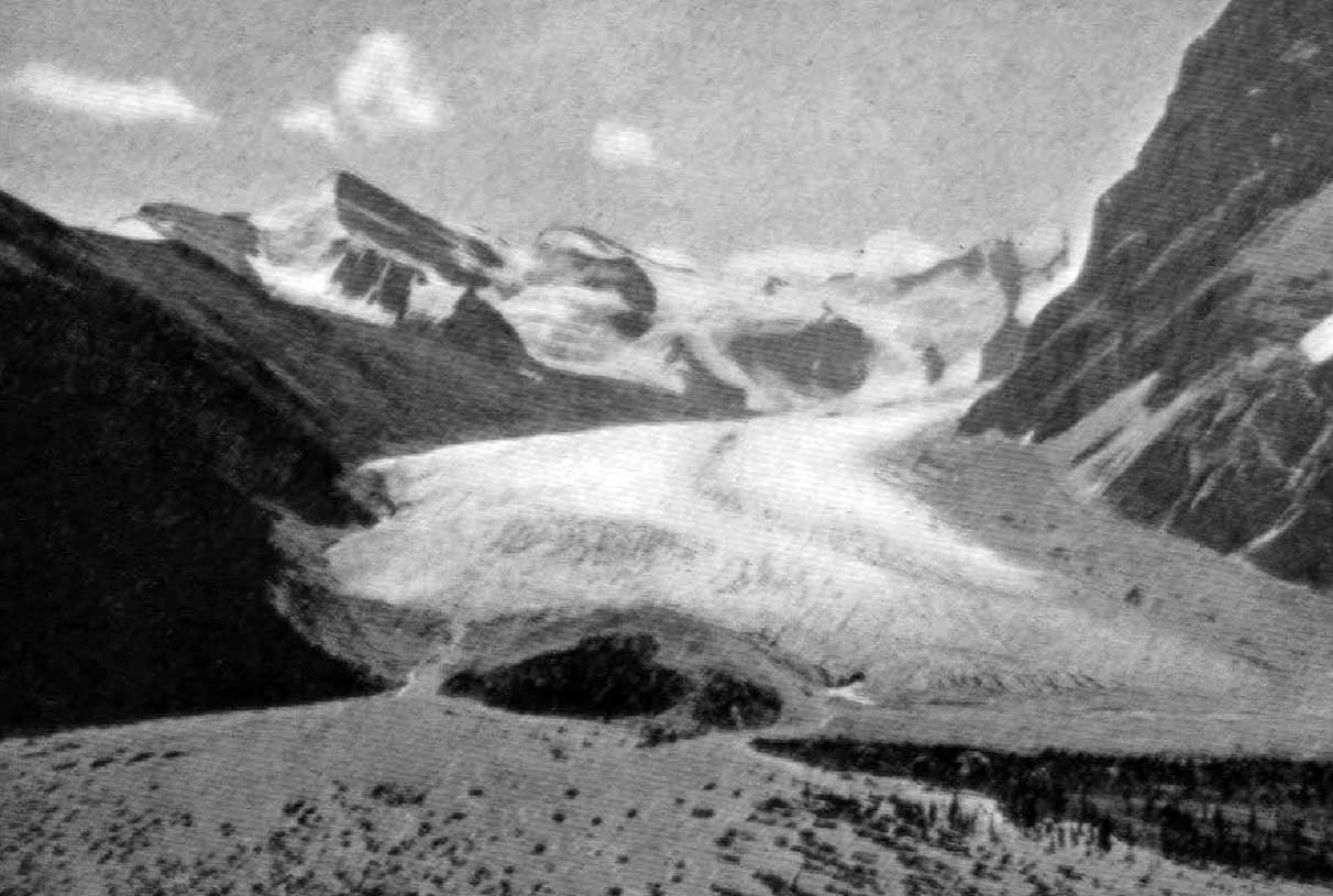
29 miles west of the Yellowhead Pass on the Canadian National Railway
Grand Trunk Pacific Railway station built in 1912. Renamed as Selwyn
A. Y. Jackson, Resplendent, B.C., 1914. Photo by John Monroe.

A. Y. Jackson, Resplendent, B.C., 1914. Photo by John Monroe.
University of British Columbia Library, Rare Books and Special Collections, Nan Cheney Fonds (BC1849/160)

During the construction of the Grand Trunk Pacific Railway, Resplendent, or Mile 29 west of the Yellowhead Pass, was the end of steel in May 1912.

I left Vancouver on May 20th [1912], with a party of twelve men to survey land within the reserve on the south fork of the Fraser River, about fifty miles below Tête Jaune Cache. There are three different routes to get into this country, probably the most expeditious one being via Edmonton — the way we went. Taking from Edmonton, by special permission of the Railway Commission, we travelled over the Grand Trunk Pacific as far as the end of steel, which at that time was Resplendent, twenty-nine miles west of the British Columbia-Alberta boundary. Owing to the fact that the Grand Trunk has not been opened for traffic farther west than Hinton, 185 miles west of Edmonton, it was necessary to get this special permission before we were allowed to travel the remaining ninety-eight miles to the end of steel.

— A. P. Augustine

(The south fork of the Fraser River is the main branch of the river; the North Fork is now known as the McGregor River.)

References:

  • Wheeler, Arthur Oliver [1860–1945]. “Topographical Map Showing Mount Robson and Mountains of the Continental Divide North of Yellowhead Pass to accompany the Report of the Alpine Club of Canada’s Expedition 1911. From Photographic Surveys by Arthur O. Wheeler; A.C.C. Director.” Canadian Alpine Journal, Vol. 4 (1912):8-81
  • Augustine, Alpheus Price [d. 1928]. “Report on Surveys on the South Fork of Fraser River.” Report of the Minister of Lands for the Province of British Columbia for the year ending 31st December 1912, (1913):240-242. Google Books
  • Bohi, Charles W., and Kozma, Leslie S. Canadian National’s Western Stations. Don Mills, Ontario: Fitzhenry & Whiteside, 2002

Resplendent Mountain

British Columbia. Mountain
NE of Mount Robson
53.0833 N 119.0833 W — Map 83E/3 — GoogleGeoHackBivouac
Earliest known reference to this name is 1910 (Coleman)
Name officially adopted in 1923
Official in BCCanada
Elevation: 3408 m
Summit of Mt. Resplendent. The Ice Horn
Photo: Byron Harmon, 1913

Summit of Mt. Resplendent. The Ice Horn
Photo: Byron Harmon, 1913
Canadian Alpine Journal 1915


Mount Robson - Glacier looking towards Resplendent
William James Topley, 1914

Mount Robson – Glacier looking towards Resplendent
William James Topley, 1914
Library and Archives Canada

Clinging to our doubtful footholds, we were not in a mood to delay long at the highest point, and yet we could not help delighting in the marvellous view over the great glacier, the Helmet, the Rearguard, the lovely lakes in the valley to the north, and white-robed Mount Resplendent rising probably a thousand feet above us close by to the east, with numberless mountains in all directions beyond these nearer summits.

— Coleman, p. 325

Arthur Philemon Coleman [1852–1939] explored around Mount Robson in 1907 and 1908. He wrote of his 1908 visit in the quote above. His book The Canadian Rockies: New and Old Trails contains a couple of other uses of “resplendent:”

Passing through Fletcher’s ranch, sleek cows eyed us placidly, and men at work in the yellow oatfields stopped to look at us. This morning Jimmy had appeared once more in the long-tailed black coat, and Mark was resplendent in a newly pipeclayed hat, all his beads round his neck and on his long forelocks, and with a little sleigh-bell tinkling on his bridle. The white men had no finery to put on, and looked ragged and poverty-stricken as compared with the red men. [p. 166]

On our way to Moberly’s two young halfbreed swells passed us in the same direction on fine horses with showy trappings, and later we made the closer acquaintance of one of them, Adolphus Moberly, resplendent in one of the silk-embroidered buck- skin suits just mentioned and with a mirror flashing on the brow of his sleek black pony. We engaged him as guide to the rear of Mount Robson. [p. 302]

“[Resplendent Mountain] was named, and well named, by Coleman,” wrote Arthur Oliver Wheeler [1860–1945] in the report of the 1911 Alpine Club of Canada–Smithsonian Robson Expedition. “On the east side it is clad from top to bottom in pure white snow, and presents with the sun shining upon it a spectacle of such wonderful brilliance that the aptness of the name became immediately apparent. It rose in great snow masses and ice walls sheer to the summit, and showed several of the largest and widest bergschrunds I have ever seen in the Rockies. Enormous cornices overhung on the north and east sides. Later, the mountain was ascended by Konrad Kain and Byron Harmon. It proved to be altogether a snow and ice climb, and Konrad reported having seen some of the greatest ice cracks he had met with throughout the course of his professional experience. The crest of the mountain he described as an immense cornice reaching far out into space over the depths below.”

Conrad Kain [1883–1934] was guide on the expedition; Byron Harmon [1876–1942] was photographer.

The name was officially adopted in 1923 as labelled on Wheeler’s map .

References:

  • Coleman, Arthur Philemon [1852–1939]. The Canadian Rockies: New and Old Trails. London: T. Fisher Unwin, 1911, p. 325. Internet Archive
  • Alpine Club of Canada [1906–]. “Exploration in the Yellowhead.” Canadian Alpine Journal, Vol. 3 (1911):117
  • Wheeler, Arthur Oliver [1860–1945]. “The Mountains of the Yellowhead Pass.” Alpine Journal, Vol. 26, No.198 (1912):382
  • Wheeler, Arthur Oliver [1860–1945]. “The Alpine Club of Canada’s expedition to Jasper Park, Yellowhead Pass and Mount Robson region, 1911.” Canadian Alpine Journal, Vol. 4 (1912):9-80
  • Mitchell, Charles Hamilton [1872–1941]. “Mt. Resplendent and the routes of ascent.” Canadian Alpine Journal, Vol. 6 (1914–1915):50–58

Resplendent Creek

British Columbia. Creek: Fraser River drainage
Flows SE into Moose River, N of Moose Lake
52.9939 N 118.8672 W — Map 083D15 — GoogleGeoHack
Name officially adopted in 1923
Official in BCCanada

The headwaters are on the eastern slopes of Resplendent Mountain.

Reef Icefield

British Columbia. Icefield: Fraser River drainage
E of Berg Lake, NE of Kinney Lake
53.1333 N 119.0167 W — Map 83E/3 — GoogleGeoHack
Earliest known reference to this name is 1911 (Wheeler)
Official in BCTopo map from Canadian Geographical Names
Icefall of Reef Glacier (Western flow). Photo, Byron Harmon, 1911.

Icefall of Reef Glacier (Western flow). Photo, Byron Harmon, 1911. Canadian Alpine Journal 1912,p. 26

“The glacier at the head of the west branch of the Moose River was named Reef Glacier by Dr. A. P. Coleman on one of his expeditions to Mount Robson,” according to Arthur Oliver Wheeler [1860–1945]. “It is so called on account of the rock ridges, or nunataks, which appear like reefs rising from the snowfield.”

Arthur Philemon Coleman [1852–1939] visited Mount Robson in 1907 and 1908. There is no reference to Reef Glacier or Icefield in Coleman’s The Canadian Rockies: New and Old Trails, 1911.

References:

  • Coleman, Arthur Philemon [1852–1939]. The Canadian Rockies: New and Old Trails. London: T. Fisher Unwin, 1911. Internet Archive [accessed 3 March 2025]
  • Wheeler, Arthur Oliver Oliver [1860–1945]. “The Mountains of the Yellowhead Pass.” Alpine Journal, Vol. 26, No.198 (1912):382
  • Wheeler, Arthur Oliver Oliver [1860–1945]. “The Alpine Club of Canada’s expedition to Jasper Park, Yellowhead Pass and Mount Robson region, 1911.” Canadian Alpine Journal, Vol. 4 (1912):9-80. Alpine Club of Canada
Also see:

Red Tail Road

British Columbia. Road
Forks N off Museum Road, W of McBride
53.3223 N 120.195 W GoogleGeoHack
Roads are not in the official geographical names databases

Named for the locally common red-tailed hawk by Abigail E Swanson (b. Akron, Ohio, 1948), whose family lived on the road from 1975 to 1990.

Redoubt Peak

Alberta-BC boundary. Peak
Between heads of Geikie Creek andTonquin Creek
52.6906 N 118.2917 W — Map 83D/9 — GoogleGeoHackBivouac
Earliest known reference to this name is 1916 (Wheeler)
Name officially adopted in 1935
Official in BCCanada
Elevation: 3109 m
Ptarmigan Lake and Mt. Redoubt. Photo, F.W. Freeborn

Ptarmigan Lake and Mt. Redoubt. Photo, F.W. Freeborn
Canadian Alpine Journal 1916


Tonquin Pass and Geikie Range from the North (Vista Peak).
Photo, A.0. Wheeler

In fortifications, “redoubts” are works constructed within others, in order to prolong their defense or afford a retreat for troops. The name was known at the 1915 Alpine Club of Canada annual mountaineering camp at Ptarmigan Lake.

The peak was first climbed in 1927 by F. H. Slark and F. Rutis, who met with a fatal accident on descending. Their bodies were never found.

References:

  • Wheeler, Arthur Oliver [1860–1945]. “Report of Ptarmigan Lake Camp.” Canadian Alpine Journal, Vol. 7 (1916):89-96
Also see:

Red Pass junction

British Columbia. Railway point and former locality
W end of Moose Lake
52.986 N 119.0045 W — Map 083D14 — GoogleGeoHack
Earliest known reference to this name is 1911 (Wheeler)
Name officially adopted in 1983
Official in BCTopo map from Canadian Geographical Names
26 miles west of the Yellowhead Pass on the Canadian National Railway
Mile 0 in Tete Jaune Subdivision (Red Pass to McBride as of 1977)
Mile 44 in Albreda Subdivision (Jasper to Blue River as of 1977)
Topographical Map Showing Mount Robson and Mountains of the Continental Divide North of Yellowhead Pass. Detail of Moose Lake. 1912

Topographical Map Showing Mount Robson and Mountains of the Continental Divide North of Yellowhead Pass. Detail of Moose Lake. 1912 Victoria Library, University of Toronto


Water tower and locomotive at Red Pass station. Canadian National steam engine 6057 (manufactured by Montreal Locomotive Works in 1930 and scrapped in 1960, 4-8-2, U-1-e).

Water tower and locomotive at Red Pass station. Canadian National steam engine 6057 (manufactured by Montreal Locomotive Works in 1930 and scrapped in 1960, 4-8-2, U-1-e). Valemount & Area Museum


Red Pass before 1949; colour tinted at a later date. Ishbel Cochrane.

Red Pass before 1949; colour tinted at a later date. Ishbel Cochrane. Valemount & Area Museum

The Red Pass railway point on Arthur Wheeler’s 1912 Topographical Map Showing Mount Robson and Mountains of the Continental Divide North of Yellowhead Pass is located near the middle of Moose Lake, not at the current location on the western end. The Grand Trunk Pacific Railway was the only railway through the pass at that time. The railway junction at Mile 27 at the west end of Moose Lake was originally called Resplendent, a name also deriving from the color of the rocks.

East of Red Pass junction, the tracks of the Grand Trunk Pacific Railway, descending to the Fraser River on route to Prince George in 1912, were kept as low as possible. The tracks of the Canadian Northern Railway, heading for Albreda, were kept high. After the consolidation of the railways in 1923 as the Canadian National Railway, Lucerne disappeared as a divisional point and Resplendent blossomed as the current Red Pass Junction, the point where the removal of the separate tracks stopped and where the two lines diverged. Red Pass probably had a GTP Type E station at one time.

During the 1930s there was a hobo jungle at Red Pass where the vagabonds waited for trains. About 50 people lived at Red Pass in the 1940s. During World War II it was the site of a Japanese internment camp. The Red Pass hotel burned down in 1949. After the highway opened in 1962, the need for Red Pass diminished. Canadian National Railway still uses some buildings at Red Pass. The headquarters of Mount Robson Park were moved from Red Pass to Valemount in 1987. The lower railway line has since been discontinued and the junction was moved near Charles north of Valemount.

The post office was open from 1921 to 1976, when it was closed and moved to Valemount.
Postmasters:

C. W. Palmer 1921-1923
Earl Francis Woodley 1923-1946
Lloyd Francis Williams 1946-1967
Robert Francis McLeod 1967-1969
Lionel D. Young 1969-1972
Mrs Diane Audrey Rogers 1972-1973
Mrs Winnifred Lynn Castle 1973-1974
Mrs Margaret Wentzel 1974-1976
Mrs M. A. Watt 1976
Mrs P. Murphy 1976

Wrigleys 1918 Directory lists Red Pass junction as a “flag-station on the G. T. P. Ry., 22 miles west of Lucerne. Lucerne is nearest post office.”

The Jasper Booster weekly newspaper published a story on August 12, 1981, entitled “Mayor of Red Pass Steps Down”:

Since the end of July, Red Pass has been without a mayor and it is doubtful that the position will be filled in the near future. In fact, the mayor’s residence and office will no longer be available to serve as town hall but will be purchased by the Province of B.C. and removed from Mt Robson provincial park. The mayor has moved to Cranbrook and so ends the last private residence on the shores of Moose Lake. William Hallam (aka the mayor of Red Pass Junction or Old Bill) was a familiar face to most railroaders. Other than the CN gangs he was the only person to wave to in Red Pass and he was often out with his dog Pard checking over the trains. Many residents of Jasper would recognize Bill from his monthly trips into town to buy pipe tobacco and “visit his girlfriends.” Anyone who has ever talked to Bill knows he’s been around and he has lots of stories to prove it.

References:

  • Bohi, Charles W. Canadian National’s Western Depots. The Country Stations in Western Canada. Railfare Enterprises, 1977
  • Waxu, Warren. “Mayor of Red Pass steps down.” Jasper Booster, 12 August (1981)
  • Topping, William. A checklist of British Columbia post offices. Vancouver: published by the author, 7430 Angus Drive, 1983
  • Canadian National Railways Steam Locomotive Roster. Trainweb

Red Pass

British Columbia. Pass
N of Red Pass Junction, between Razor Peak and Mount Kain
53.0333 N 119 W — Map 83E/2 — GoogleGeoHack
Earliest known reference to this name is 1911 (Wheeler)
Name officially adopted in 1951
Official in BCCanada
This pass appears on:
Wheeler’s map Mount Robson 1912

Looking at this pass from the Moose River valley during the 1911 Alpine Club of Canada–Smithsonian Robson Expedition, surveyor Arthur Oliver Wheeler [1860–1945] wrote,

To Konrad’s disappointment the “Finger of Kain” now showed a broad slab of rock, but it must have been a very thin one. Beneath, to the south, lay deep valley which opened on the west branch valley above our camp. It supplies an easy pass to the Fraser Valley, to which it opens about two miles below the south end of Moose Lake. Seen from the Fraser Valley, the rock exposures at the crest show a brilliant red and, on this account, it is here called the “Red Pass. Examination from the Fraser side showed that the head of the valley below us contained some beautiful alplands and a that a pony trail would be possible of construction. It would be shorter from the railway than the Moose River route.

“Konrad” was guide Conrad Kain [1883–1934].

References:

  • Wheeler, Arthur Oliver [1860–1945]. “The Alpine Club of Canada’s expedition to Jasper Park, Yellowhead Pass and Mount Robson region, 1911.” Canadian Alpine Journal, Vol. 4 (1912):9-80
Also see: