Feature type: road
Province: British Columbia
Location: Forks W off Hwy 5, N of Valemount
Province: British Columbia
Location: Forks W off Hwy 5, N of Valemount
The name was adopted in 1925 to recognize surveyor Dalby Brooks Morkill [1880–1955].
Morkill was born in Sherbrooke, Québec, and came to British Columbia in 1898. He received his commission as a British Columbia Land Surveyor in 1910. Morkill was employed in 1912 by the British Columbia government making surveys on the Fraser River between Horsey Creek and Holmes River. In 1913, with Alan S. Thompson, Morkill surveyed between Goat River and Catfish Creek.
Morkill worked on the Alberta-British Columbia Boundary Commission surveys north of Yellowhead Pass in the early 1920s. Subsequently Morkill surveyed in several other areas of the Province. During his last years he spent summers at his residence at Barkerville and winters in Vancouver.
The Morkill River is known locally as the Smoky River, a name that dates back to at least 1909. (There is also a Smoky River in Alberta, headwaters at Robson Pass.)
Joe Morgan, one of McBride’s earliest pioneers, homesteaded the Cedarbrook Ranch in 1914. They say he was a barber.
Named after one of the workers on the construction of this section of the Canadian Northern Railway in the 1910s.
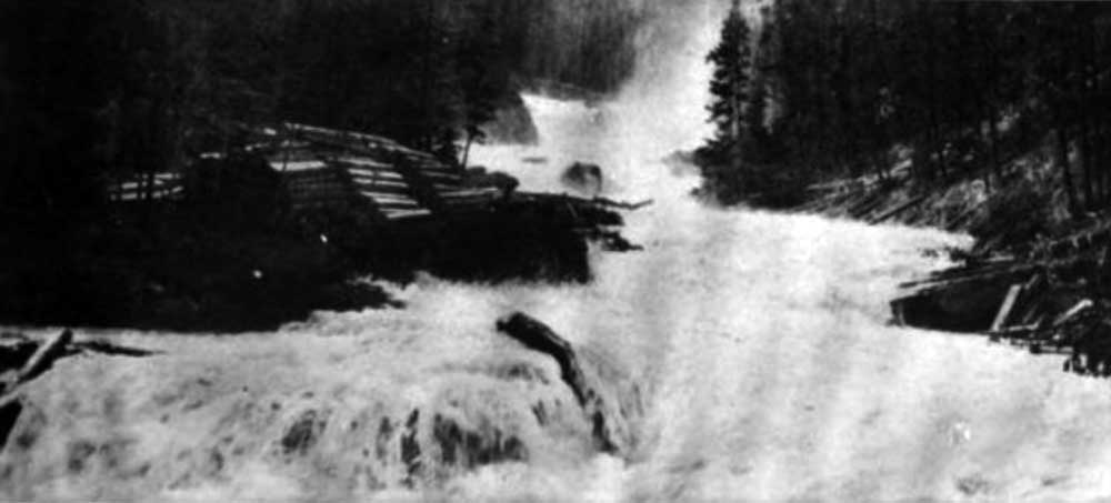
Driving ties on Moose River. This river-valley contains about twenty square miles of unalienated timber.
Report of the Minister of Lands for British Columbia for the yer ending December 31, 1912
Soon after we started, we came to Moose River, which was somewhat difficult to ford, for the water was high and rapid, pouring over the horses’ shoulders in the deepest part. Mr. O’B[ierne] lost nerve and steered badly, his horse lost its footing, and nearly took a voyage into the Fraser; the rider, however, gripped mane and saddle firmly, and both got ashore together, adding another hair’s-breadth escape to Mr. O’B.’s list.
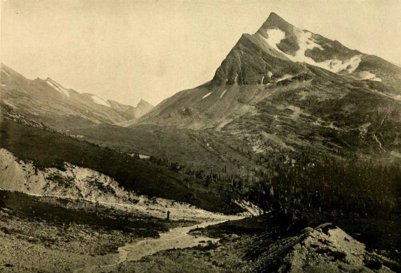
View of Moose Pass and Tah Peak: our camp was in the forest on the right. Photo by R. C. W. Lett, by courtesy of Grand Trunk Pacific Railway
National Geographic Magazine 1913
The Coleman trail was established by Arthur Philemon Coleman [1852–1939] on his unsuccessful attempts to climb Mount Robson in 1907 and 1908.
“Moose Pass station” appears on the 1912 topographical map of the Mount Robson region by surveyor Arthur Oliver Wheeler [1860–1945]
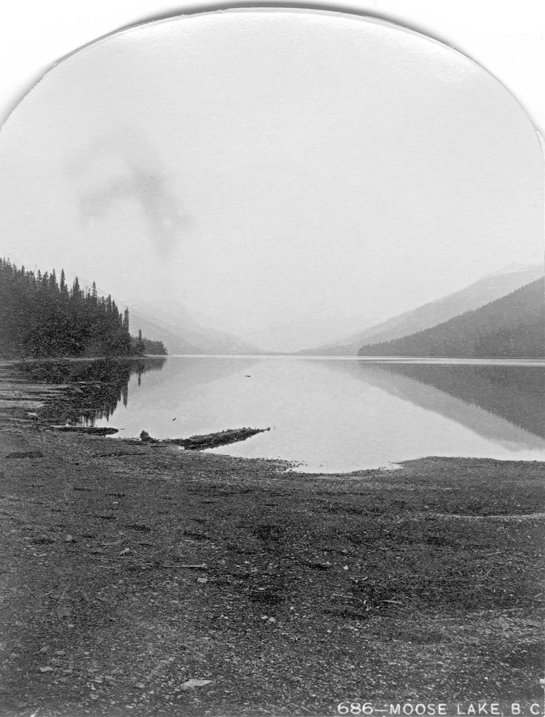
Moose Lake. Benjamin F. Baltzly, 1871
McCord Stewart Museum
Moose Lake. Photo: Mary Schäffer, 1908
Whyte Museum of the Canadian Rockies
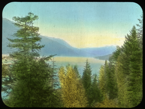
Among the 180 or so Moose Lakes in Canada, the Moose Lake in Mount Robson Park was mentioned by Hudson’s Bay Company governor George Simpson [1792–1860] in 1824 when, “to draw the Freemen further into the Mountain than they had been in the habit of going,” he proposed to establish a winter fur trading post at “Moose or Cranberry Lake.” (Cranberry Lake is south of Tête Jaune Cache.) In the fall of that year, chief trader Joseph Felix LaRocque set out to establish the post as a replacement for the post at Smoky River, but was stopped by ice in the Athabasca River and built a post above Jasper House. No fur-trade establishment was ever built at Moose Lake.
“Orignal” is Canadian French for “moose. ” On John Arrowsmith’s 1859 map of British Columbia, Moose Lake appears as “Lac L’Original” [sic].
British tourists Milton and Cheadle passed by the lake in 1863:
Moose Lake is a fine sheet of water, about 15 miles in length, and not more than three miles in breadth at the widest point, The scenery was very wild and grand, and forcibly reminded us of Wast Water. On the south side, the hills rose perpendicularly out of the water for perhaps 2,000 feet, beyond which was the usual background of rocky and hoary peaks. Over the edge of this mighty precipice a row of silver streams poured with unbroken fall, the smaller ones dissipated in mist and spray ere they reached the lake below.
During the construction of the Grand Trunk Pacific Railway around 1910, “Mile 28’’ was the camp at the west end of Moose Lake, close to the current Red Pass Junction.
BC Parks has bathymetric maps of Moose Lake showing a maximum depth of about 80 m (275 feet): east and west (PDFs).
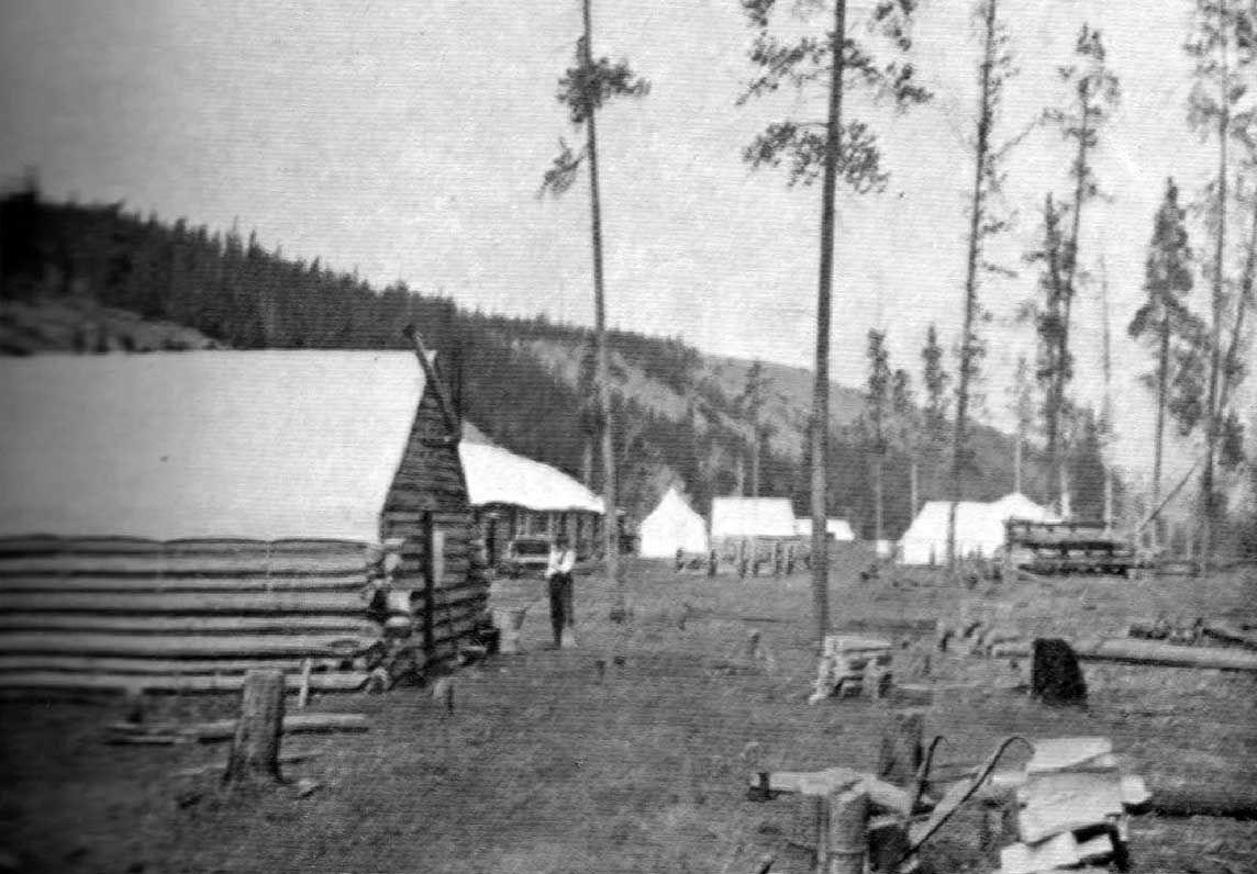
Moose City, at Mile 17. Photo: Byron Harmon, 1912
Canadian Alpine Journal 1912
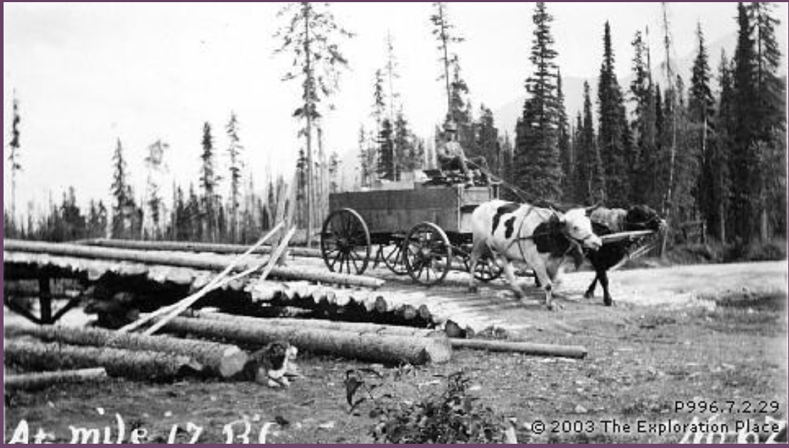
Oxen pulling cart over bridge at Mile 17 BC, 1912
Exploration Place — Fraser Fort George Regional Museum
In 1912, during his expedition to Mount Robson, Arthur Oliver Wheeler stopped at a railway construction camp on the Moose River. He found “a collection of saloons and bunk-houses of the log-wall-canvas-roof type, for the edification and comfort, or discomfort, of travellers. It glorified in the appellation of ‘Moose City,’ or, in railway parlance, ‘Mile 17.’ There was a good time in town that night. A new brand of ‘soft drink’ had arrived and, about midnight, its arrival was celebrated by a violent beating of triangles and tin cans. There was another shooting that night, but little damage was done. The town was chiefly remarkable for its brand of slick thieves. Konrad Kain [sic] had his clothes stolen, almost off his back, a considerable quantity of grub was taken and the cook’s stove abstracted while he sat upon it. However, in this section one learns to accept trifles of this kind with true philosophy, which in our case meant, buy another stove, at twice the price — on account of the freight.”
During the railway construction, Moose City was for a time the terminus of the tote road and the center of a brief mining flurry. Although a pack trail, sometimes on the hillside, sometimes in the lake, continued along the north side of Moose Lake, the railway contractors Foley, Welch and Stewart decided to move their freight on scows instead of building eight miles of tote road. Showings of gold, silver and copper on the multicolored mountain nearby attracted prospectors, and 17 miles of pack trail was started up Moose River valley.
Moose City was the site of a Japanese internment camp during World War Two. Harold Britton was killed by a train on the Moose River bridge while on guard duty in the early 1940s.
Origin of the name unknown.