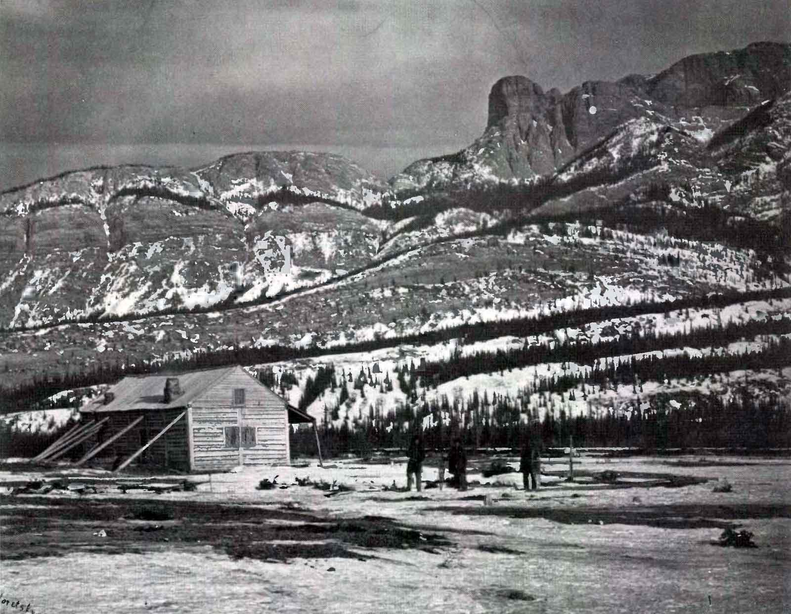
Jasper House and Roche Miette, Sandford Fleming expedition. Photo: Charles Horetzky, 1872
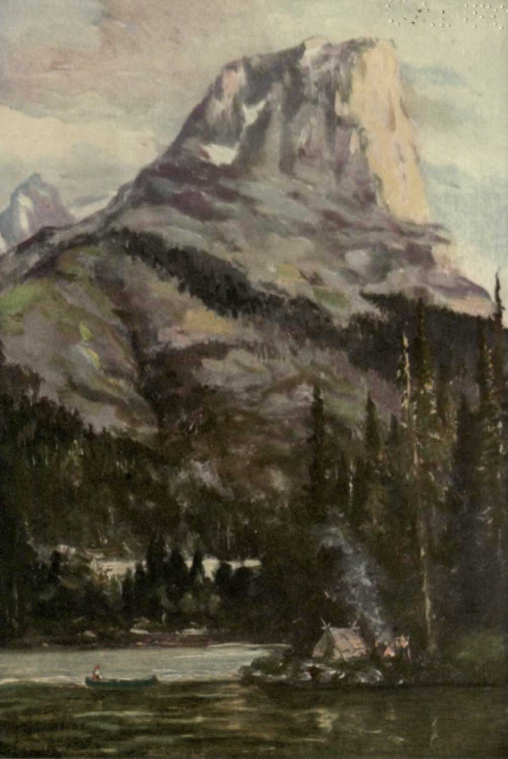
The purple crags of Roche Miette. From a painting by George Horne Russell.
In Burpee, 1914, p. 200
Internet Archive
“Roche Miette” and other local features derive their names from Baptiste Millette, an employee of the fur-trading North West Company.
When Gabriel Franchère [1786–1863] crossed the Athabasca Pass in 1814 on his way from Fort Astoria to Montréal, the name “le Rocher à Miette” was already in use. He wrote in his journal for May 18 [1]:
Nous passames un gros Cap qui s’appelle le Rocher à Miette, ou ayant sondé la profondeur de l’eau au piéd de ce rocher, nous trouvâmes la riviére en cet endroit Guéable. … Le Rocher à Miette dont j’ai parlé plus haut qui est très élevé, vue du lac représente le portail d’une Eglise prise de Côté.
[We passed a headland called Miette Rock, sounded the depth of water at its foot, and found that the [Athabasca] river could be forded at this spot.… The Miette Rock that I mentioned earlier, which is very high, when seen from the lake resembles the side view of a church portal.]
In the archives of the Hudson’s Bay Company, Parks Canada historian David Smyth has found records of at least six Miettes engaged by the North West Company in the period between 1797 and 1819 [2]:
None spelled their last name Miette; one was recorded as Millet, while the others were almost exclusively spelled Millette. One of these, a Baptiste Millette, is almost certainly the employee after whom Roche Miette and the other features are named. According to a North West Company account book of 1811-21 there was an ex-employee named Baptiste Millette or Milliette living as a freeman in the Athabasca River Department in 1812 and 1813. His trading account ends with an 1813 entry, and nothing further about him is known either before or after this time. None of the other Millettes were apparently stationed in that department.
Lieutenant Aemilius Simpson, a newly engaged Hudson’s Bay Company officer, recorded the first version of the mountain climbing story in 1826. In his journal he described ‘Milletes Rock’ and stated that it derived its name “from a Canadian, who asserted that he had ascended to its summit”.
Paul Kane [1810–1871] was told a more embellished tale in 1846 [3], while Dr. James Hector [1834–1907] recorded a simpler version in 1859 [4].
Despite the unlikely details of Kane’s story and of later versions, it is probably true that Baptiste Millette climbed Roche Miette before Franchère’s visit.
[George Horne Russell’s painting [5]]
References:
- 1. Franchère, Gabriel [1786–1863], and Lamb, William Kaye [1904–1999], editor. Journal of a Voyage to the Northwest Coast of America, in the years 1811, 1812, 1813, and 1814. Toronto: Champlain Society, 1969, pp 162, 300. Internet Archive [accessed 10 March 2025]
- 2. Smyth, David. “Jasper National Park: some fur trade place names of the Yellowhead Pass.” Canoma, Vol. 11, No. 1 (1985):33-37. Natural Resources Canada [accessed 10 March 2025]
- 3. Kane, Paul [1810–1871]. Wanderings of an artist among the Indians of North America. From Canada to Vancouver’s Island and Oregon through the Hudson’s Bay Company’s territory and back again. London: Longman, Brown, 1859. Internet Archive [accessed 10 March 2025]
- 4. Hector, James [1834–1907], and Spry, Irene Mary Biss [1907–1998], editor. “Hector’s Journal.” The papers of the Palliser Expedition 1857-60, (1968)
- 5. Burpee, Lawrence Johnstone [1873–1946]. Among the Canadian Alps. New York: John Lane, 1914. Internet Archive [accessed 11 October 2025]