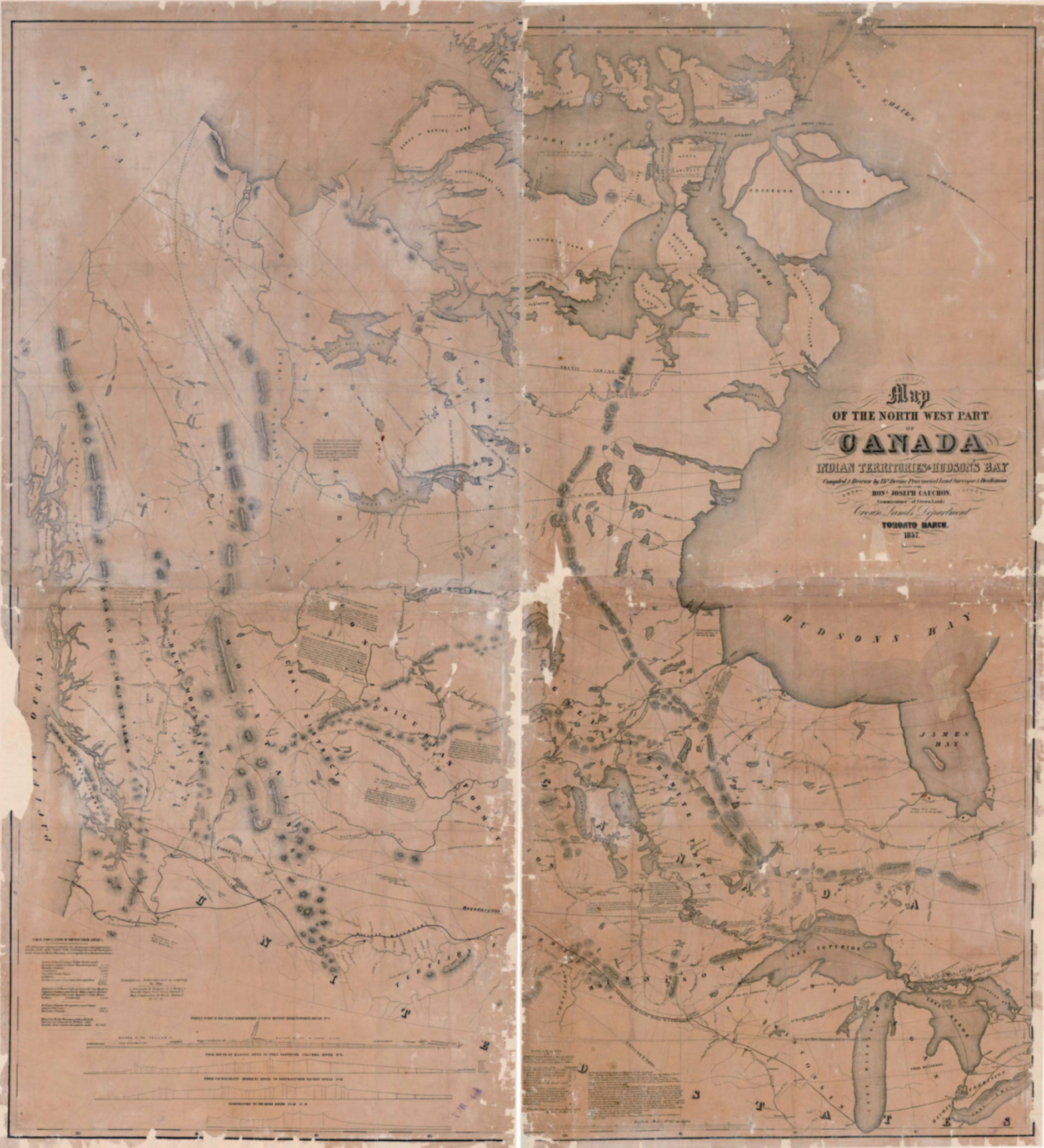
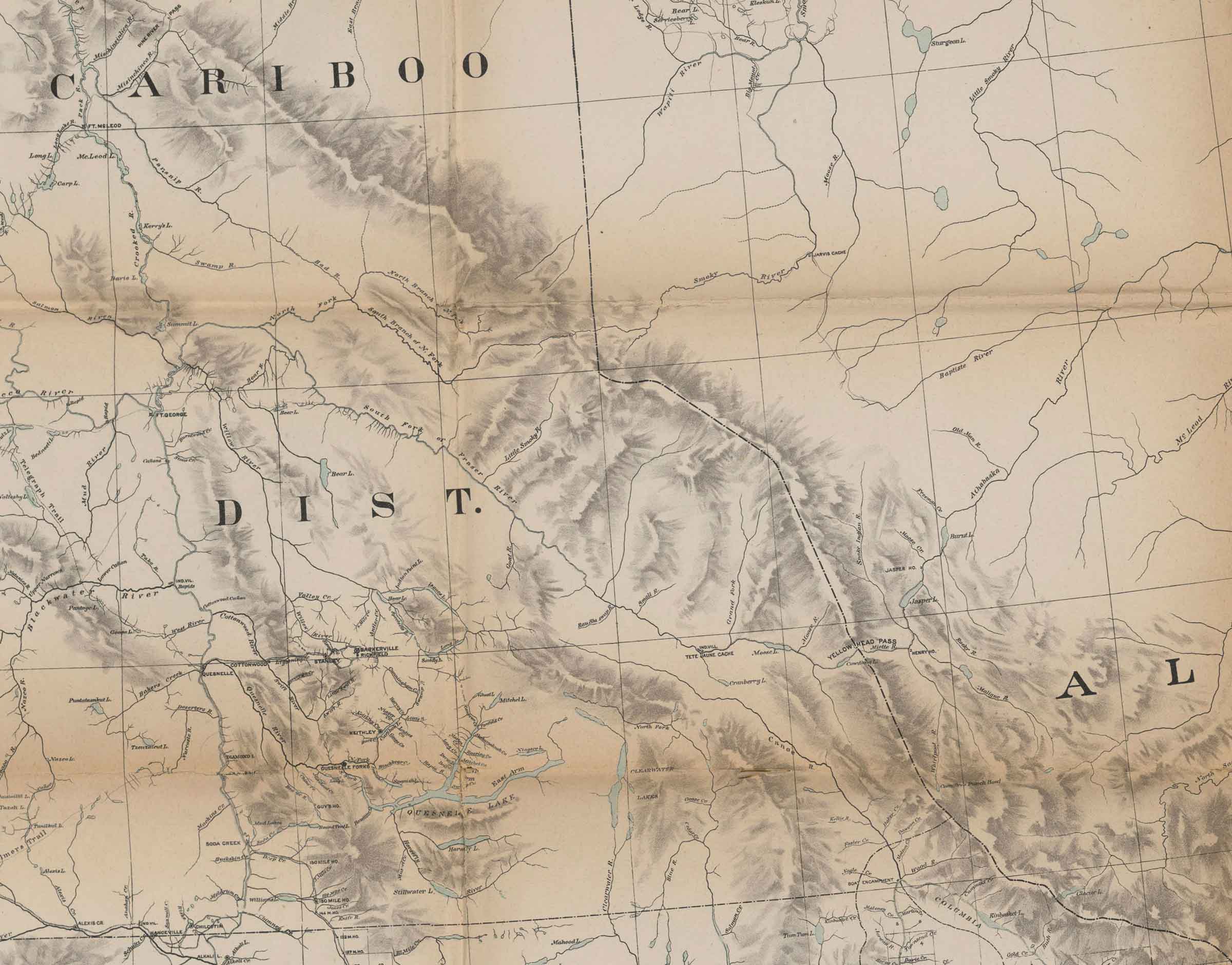
Map of the North West part of Canada.
Indian Territories & Hudson’s Bay
Library and Archives Canada [accessed 19 January 2026]
Map of the North West Part of Canada.
Indian Territories & Hudson’s Bay
Compiled & Drawn by Thos. Devine, Provincial Land Surveyor & Draftsman, by Order of the Hon. Joseph Cauchon, Commissioner of Crown Lands
Crown Lands Department
Toronto March, 1857.
Profiles of a) Route for Pacific railroad from St. Pauls Mississippi River to Puget Sound No. I, b) Mouth of Kansas River to Fort Vancouver Columbia River No. II. c) Council Bluff Missouri River to San Francisco Pacific Ocean No. III; d) Westport to the River Savier Utah No. IV Erebus & Terror Bay 1 1/2″ x 2 1/4″
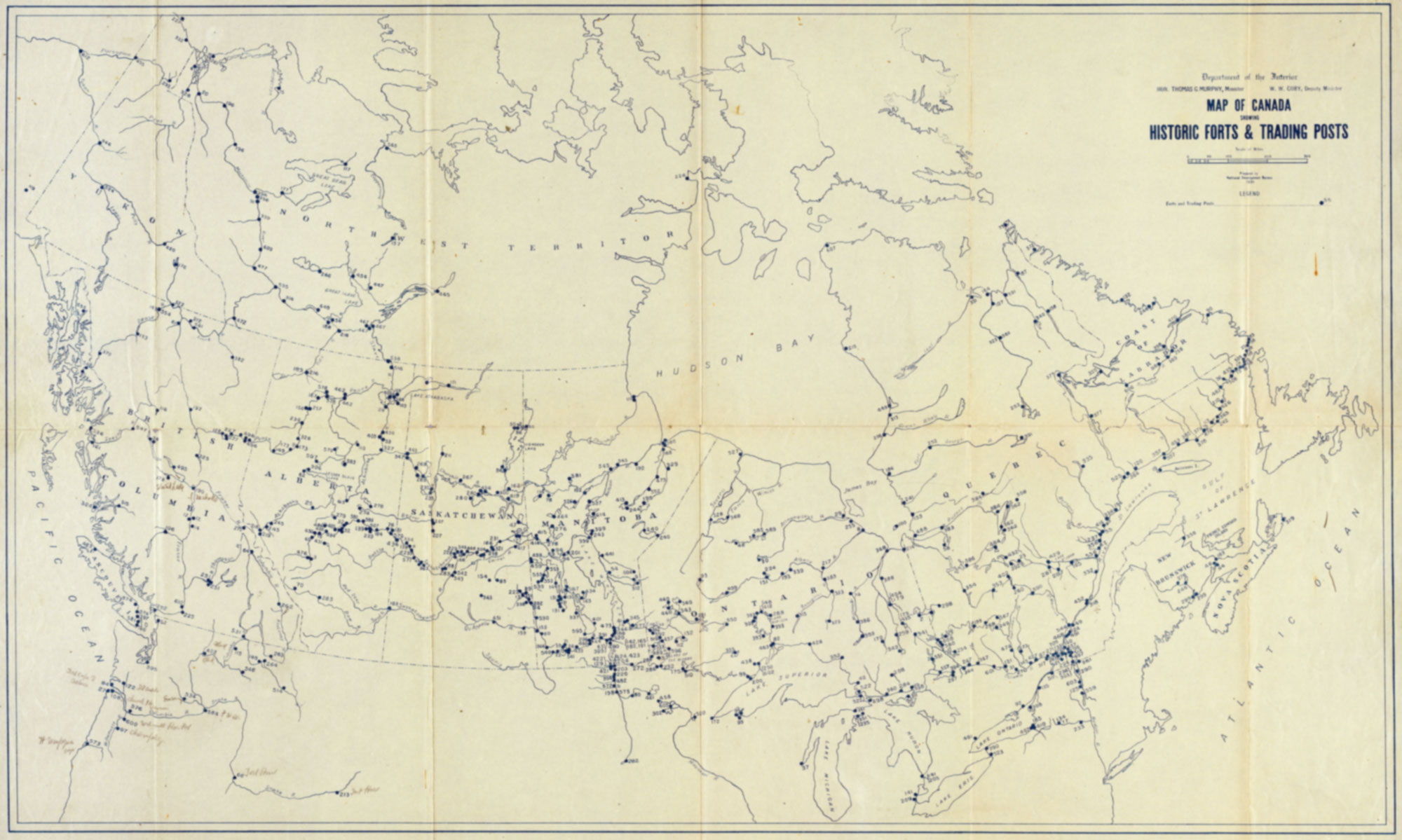
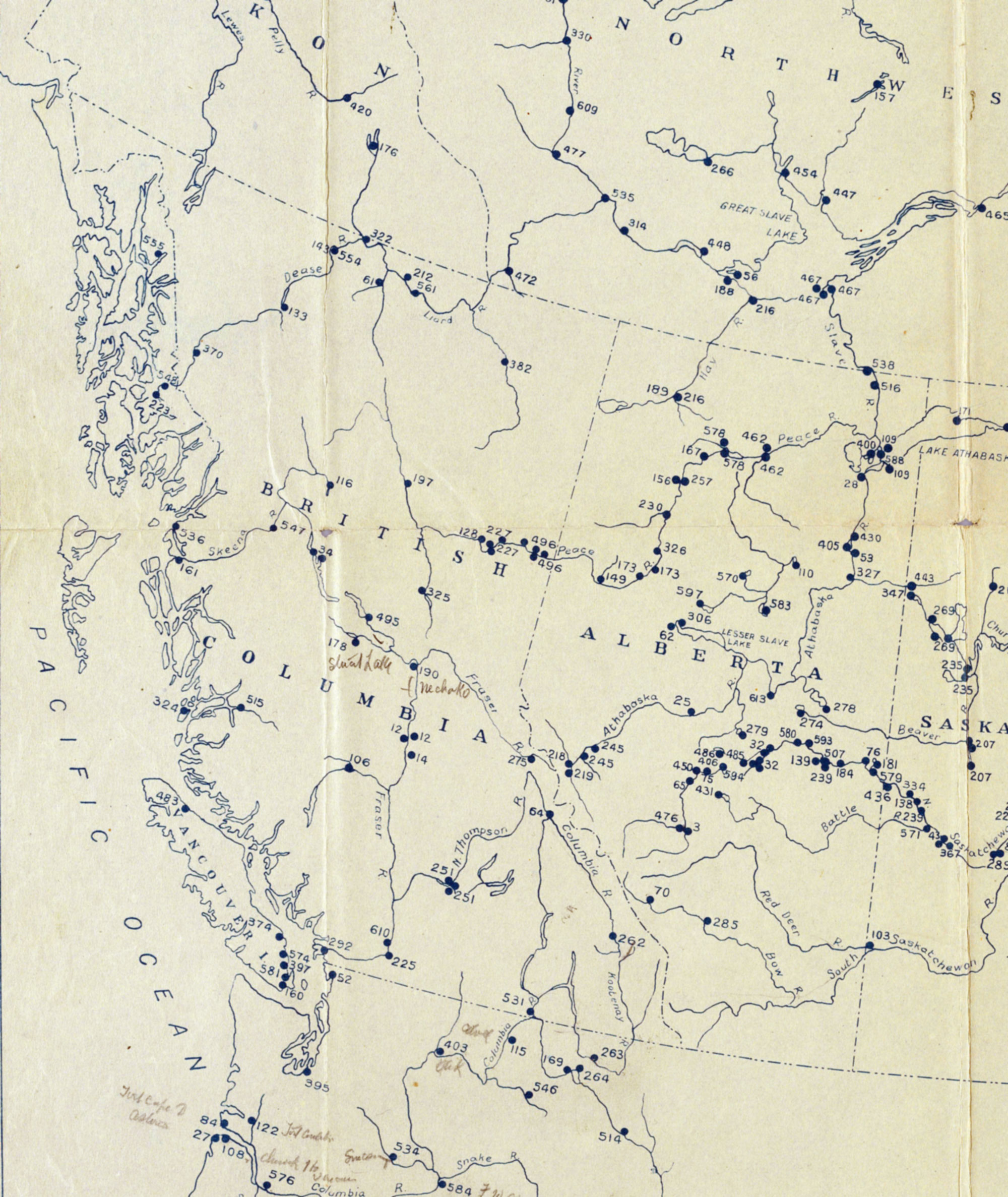
Map No. 12 in Voorhis [1].
This map includes:
Acton House
Acton House
References:
- 1. Voorhis, Ernest [1859–1933]. Historic Forts and Trading Posts of the French Régime and of the English Fur Trading Companies. Ottawa: Department of the Interior, 1930. University of British Columbia Library [accessed 3 January 2026]
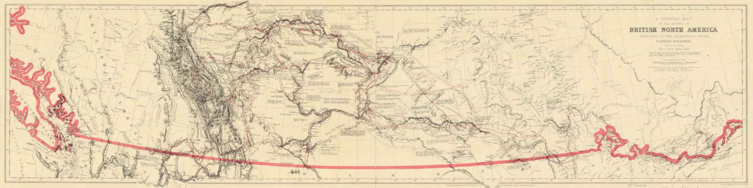
![Palliiser’s routes [detail]](/wp-content/uploads/2025/02/pallliser-detail.jpg)
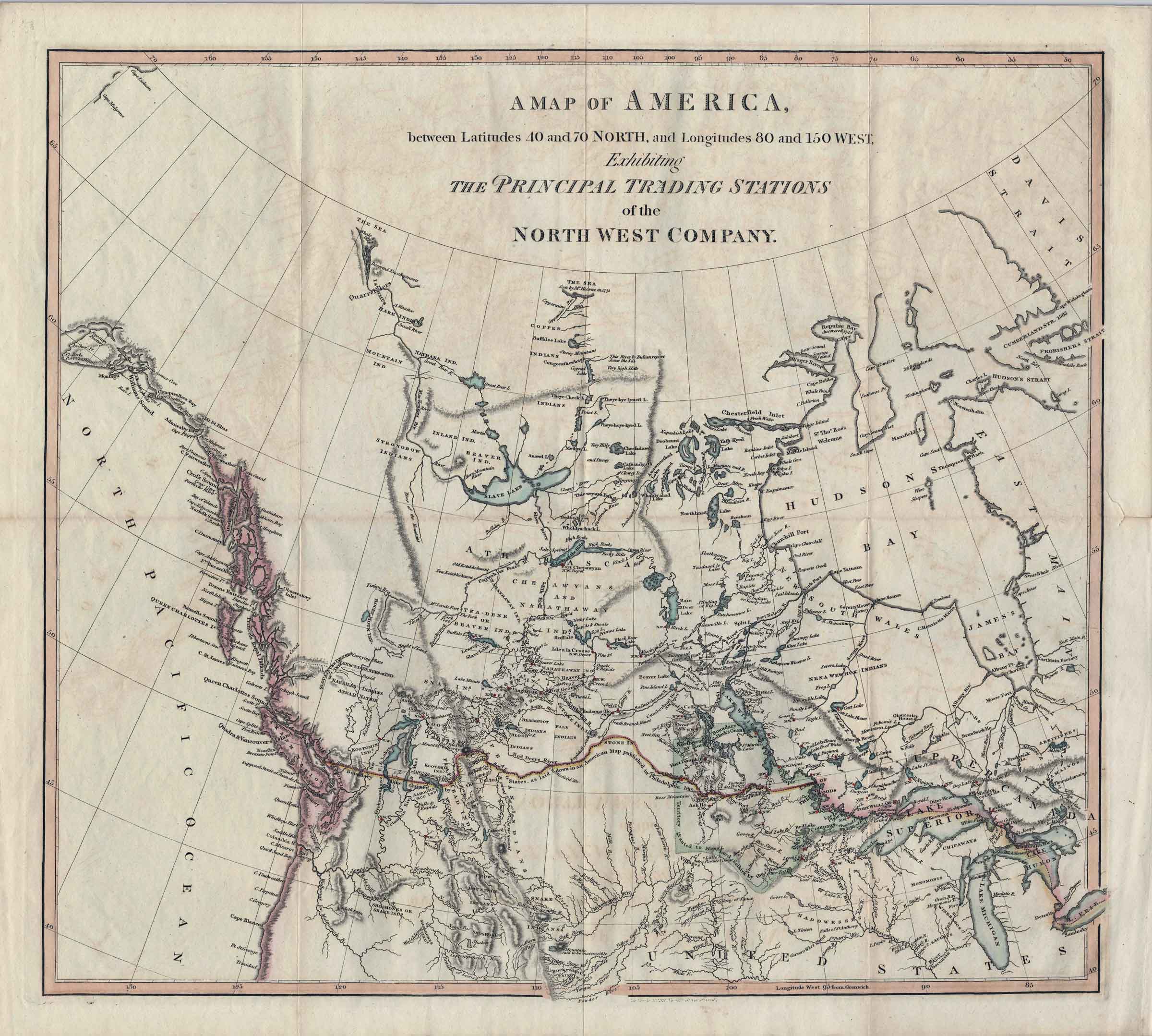
![A map exhibiting the principal trading stations of the North West Company,1817 [detail]](/wp-content/uploads/2025/01/1817-McGillivray-Notice-detail.jpg)