![Rand McNally railway map [detail], 1925](/wp-content/uploads/2022/11/cnr-map-1925.jpg)
Rand McNally railway map [detail], 1925
[1020] Excerpted from a Rand McNally map dated March 1925, reproduced in the March 1928 issue of the Official Railway Equipment Register.
This map includes:
Albreda (CNoR railway point)
Canoe River (railway point)
Clemina
Croydon
Guilford
Jackman (railway point)
Jasper
Lempriere
Longworth
Lucerne (CNoR railway point)
McBride
Mount Robson (railway point)
Rainbow (GTP railway point)
Raush Valley (railway point)
Red Pass Junction
Rooney
Shere
Snaring
Swift Creek (railway point)
Urling
Yellowhead (railway point)
References:
- Bohi, Charles W., and Kozma, Leslie S. Canadian National’s Western Stations. Don Mills, Ontario: Fitzhenry & Whiteside, 2002
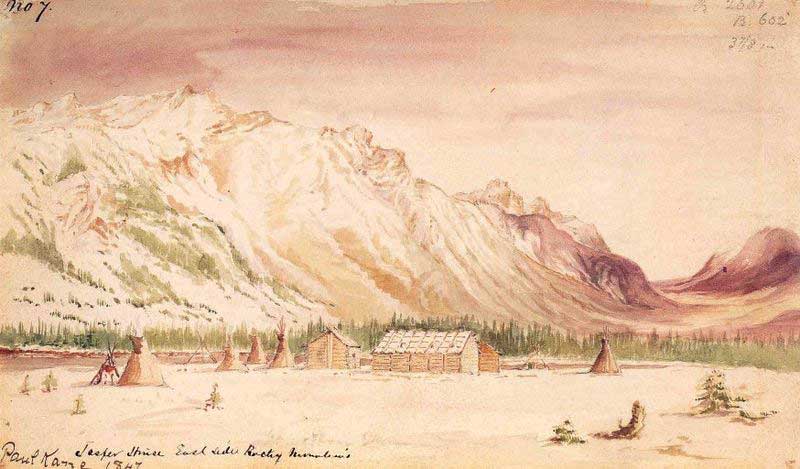
![‘Jasper House.’ Outlying trading huts of the Hudson Bay Company, near foot of the Leatherhead Pass, Rocky’s. Graves of Company’s Servants, murdered by Indian [1872]](/wp-content/uploads/2024/11/rylatt-jasper-house.jpg)