Boundary between Alberta and British Columbia. Office of the Surveyor-General, 1924
Internet Archive
Alberta-British Columbia Boundary Commission maps 1924
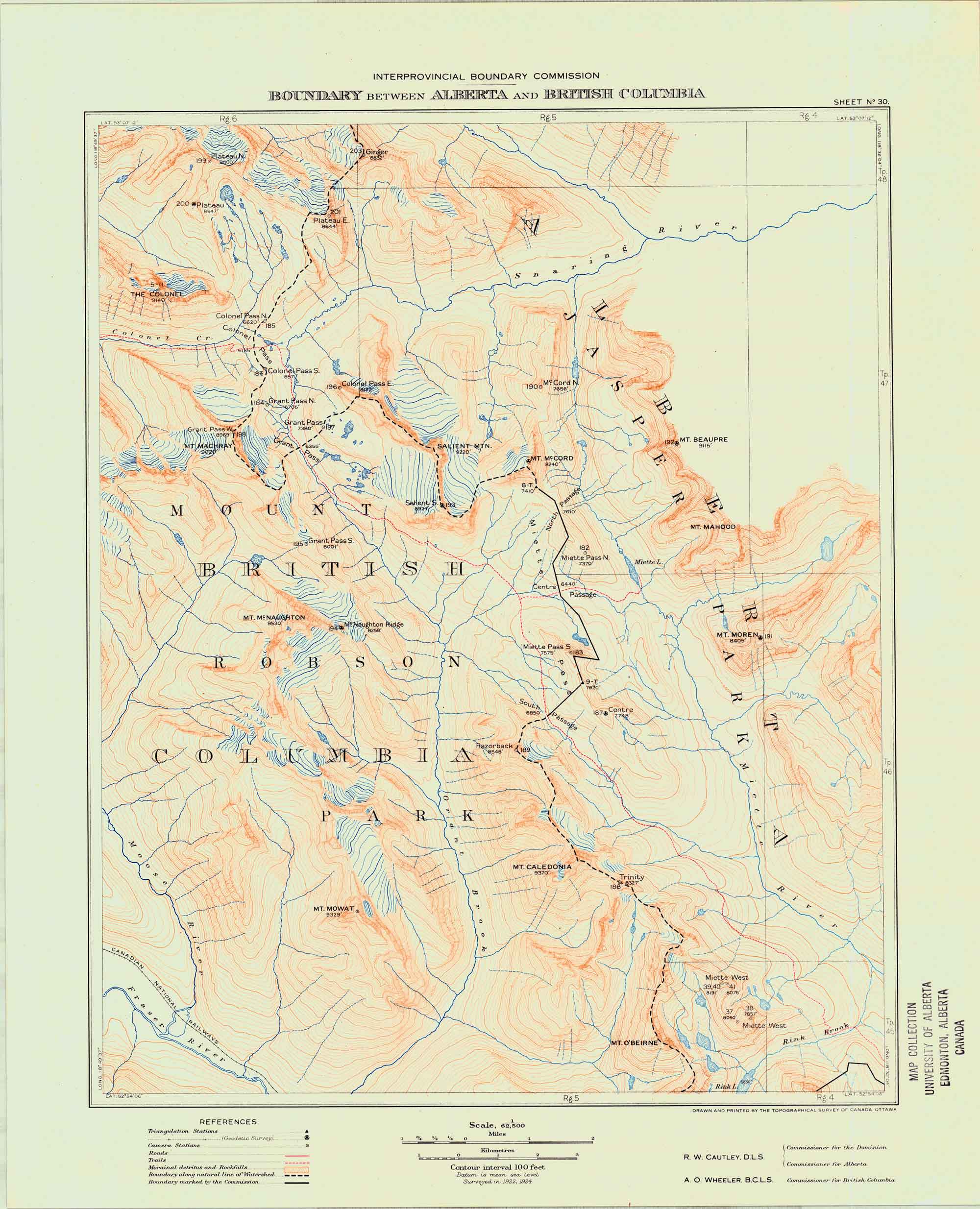
Sheet 30 — Mount O’Beirne to Colonel Pass. Surveyed in 1922, 1924
This map includes:
Mount Beaupré
Caledonia Mountain [as “Mt. Caledonia”]
Colonel Creek
The Colonel
Colonel Pass
Grant Pass
Mount Machray
Mount Mahood
Mount McCord
Mount McNaughton
McNaughton Ridge
Miette River
Miette Pass
Moren. Mount
Mount Mowat
Razorback Mountain
Rink Brook
Rink Lake
Salient Mountain
Snaring River
Mount O’Beirne
References:
- Cautley, Richard William [1873–1953], and Wheeler, Arthur Oliver [1860–1945]. Report of the Commission Appointed to Delimit the Boundary between the Provinces of Alberta and British Columbia – Part III – from 1918 to 1924. Atlas. Ottawa: Office of the Surveyor General, 1925
- Cautley, Richard William [1873–1953], and Wheeler, Arthur Oliver [1860–1945]. Report of the Commission Appointed to Delimit the Boundary between the Provinces of Alberta and British Columbia. Parts IIIA & IIIB, 1918 to 1924. From Yellowhead Pass Northerly. Ottawa: Office of the Surveyor General, 1925. Whyte Museum